When you think of Japanese cuisine, sushi and ramen come to mind. Think of Japanese clothing, it's the kimono. Think of entertainment and you have images of manga or anime pop up. What is the first think that comes to mind when you think of Japanese landscapes?
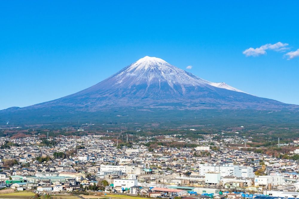
Japan's highest peak: Mt. Fuji
Mount Fuji is the highest peak in Japan at 3,776 meters above sea level. There are five freshwater lakes around Mt. Fuji (Fuji Five Lakes/Fuji Goko) and each of these are quite popular tourist destinations. Mount Fuji is also accessible in summer for about a period of three months and for those who wish to ascend this majestic mountain, this article is for you. Mt. Fuji has four main hiking trails and we have a gist of what each trail offers.
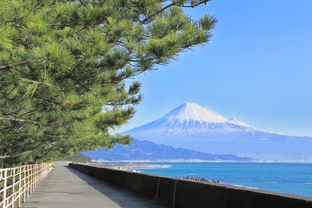
In addition to being Japan's 100 mountains, one of Japan's three famous mountains, Mount Fuji is also a World Heritage site. And without a doubt, it a symbol of Japan. Mount Fuji is still an "active volcano" and you never know when it might erupt. So one of the things you need to check before planning your trip is to confirm conditions!
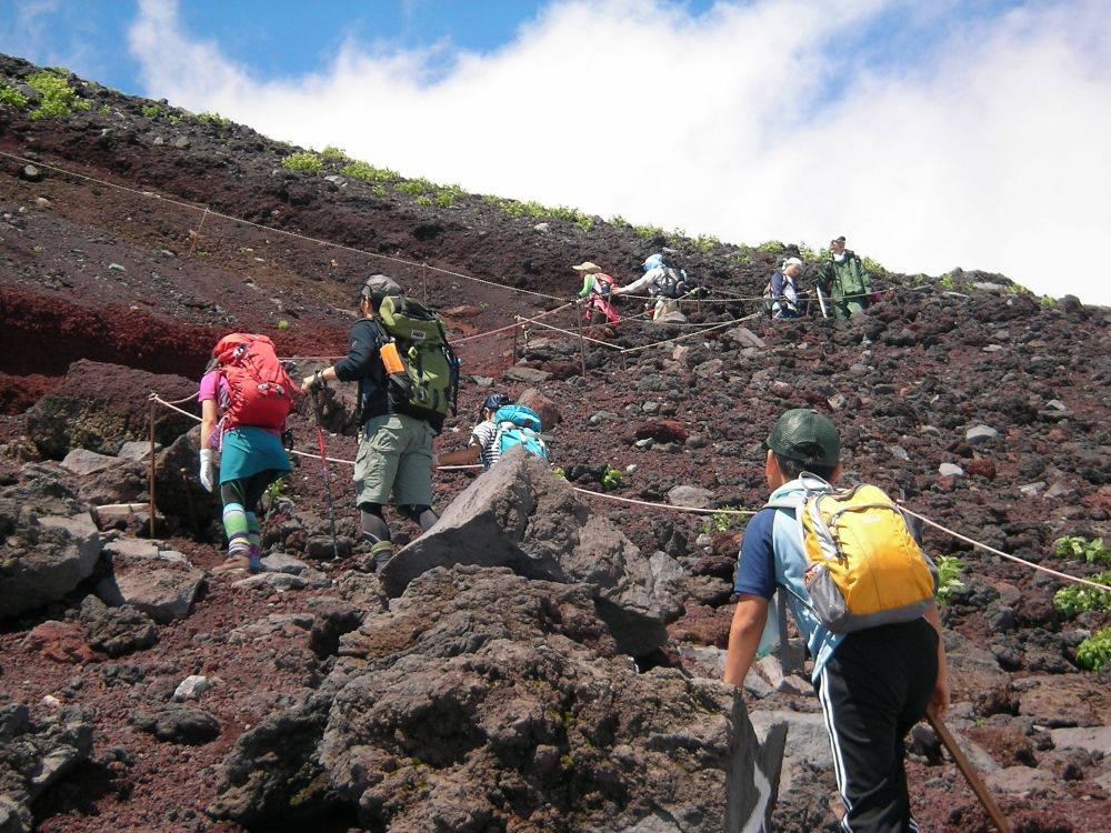
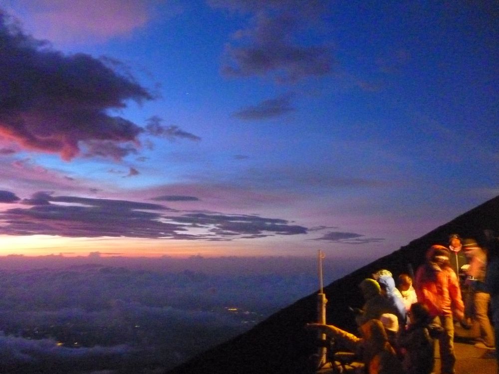
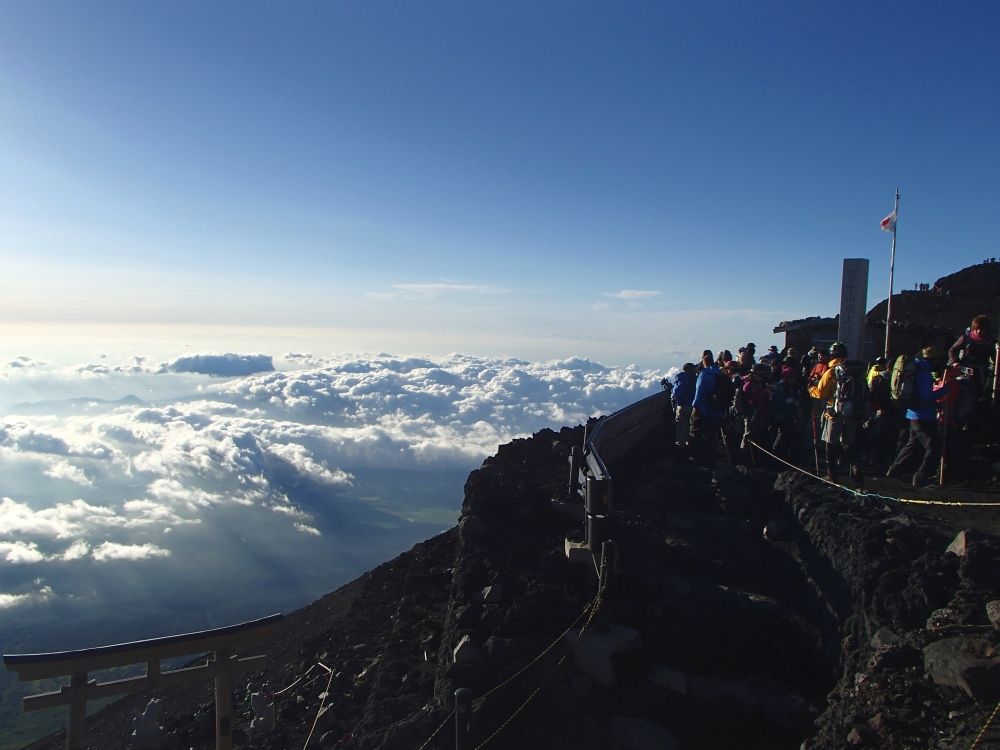
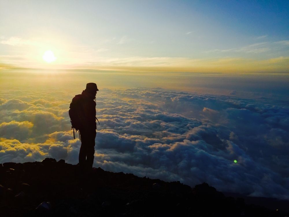
One of the other things you must know is that climbing season means crowds. Avoid weekends as far as possible as most Japanese will be climbing on these days. Sometimes you even have to queue to reach the summit so if you wish to see the sunrise from the top, make sure to start moving around 2:30 am from the 7th station to be at the top around 4:30 am.
Prepare for climbing
Timing: Mt. Fuji cannot be climbed all year round. It is only open in summer each year. The opening hours of the four trails (described below) may be different. Make sure to check the latest information.
Opening date in 2017 (for reference only):
Yoshida Trail (Yamanashi Prefecture): July 1 - September 10
Subashiri, Gotemba, Fujinomiya Trails (Shizuoka Prefecture): July 10 - September 10
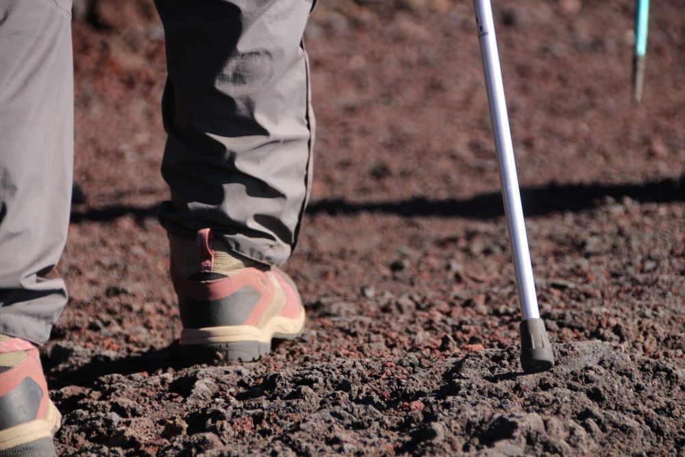
Equipment: General mountaineering equipment is necessary like hiking boots, suitable backpacks, warm clothes, gloves, headlights, money (keep enough change/coins for toilets, water, etc.) and so on. At the summit, it is extremely windy so even if you don't feel the need for layers during the climb, ensure to have an additional layer at the top.
In addition, you might also need mountaineering sticks, portable oxygen cylinders, masks, and sunglasses.
Safety: Although Mt. Fuji is not the highest mountain in the world, many unfortunate incidents take place during the climbing season. Remember to contact friends and relatives before you leave and keep emergency contacts handy. Japan's emergency numbers are 110 (police) and 119 (fire, ambulance, emergency rescue).
Avoid wearing jeans, sandals and make sure to have enough water on you. Eat well during and before your climb.
Words you need to know
xx Station: Mount Fuji is divided into ten stations starting at the foot of the mountain up till the summit; most people start climbing Mt. Fuji climbed from the 5th station.
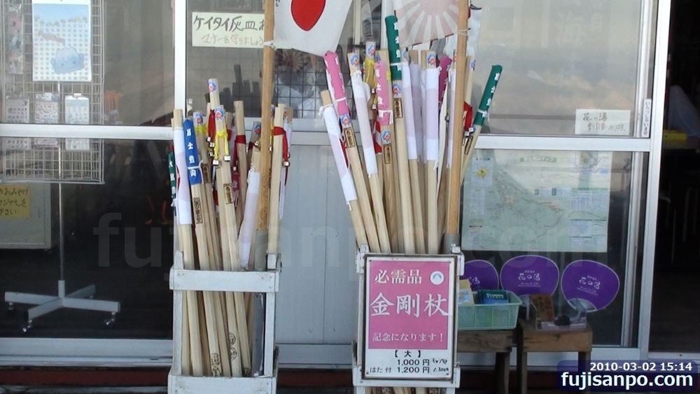
Kongoudzue: A wooden stick or pilgrim's staff can be purchased for 1000 yen. You get five and in addition to being used as a trekking pole, you can a "yaki-in," a burned seal at each station for 300-500 yen.
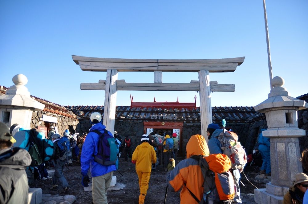
Kengamine: The highest peak of Mount Fuji at 3776.24m. Try challenging yourself and get through this final stretch. Be careful as the loose pebbles and dirt path is slippery.
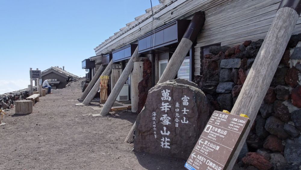
Yamagoya: Mountain huts are small, comfortable lodgings for mountaineers to stay during the climb. In the price per night, you get meals too but make sure to reserve well in advance.
There are different mountain huts on each of the trails. To know more, continue reading! Make sure to confirm that the mountain hut you plan to reserve is on the trail you wish to climb.
CAUTION:
1) Most mountain huts accept only cash. Remember to bring enough cash with you.
2) Normally, there is no bathroom.
3) You will be allotted minimal space usually enough for one person to lie down.
4) Mountain huts are more of a place to rest than a kind of hotel. Do not expect services like that of a hotel or ryokan.
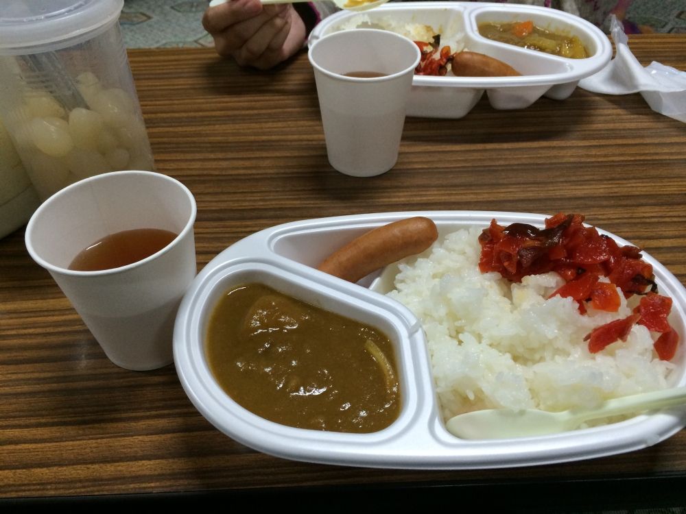
Most mountain houses offer Japanese-style curry rice as a meal!
Oxygen: Sanso in Japanese. If you want to buy oxygen, remember to recognize these characters 酸素. If you have experienced altitude sickness in the past, you might require this closer to the summit. Make sure to carry your own medicines as well.
Choosing the trail
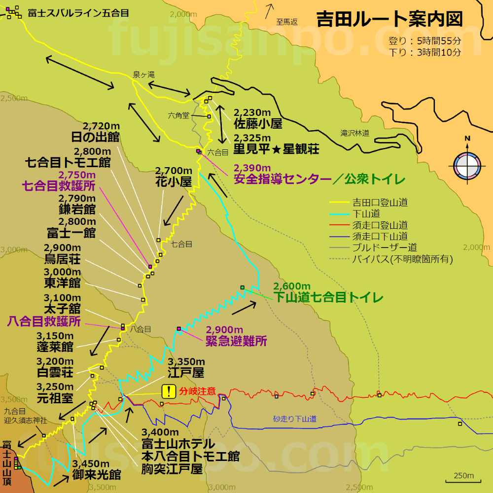
Mount Fuji has four trails: (1) Yoshida Trail, (2) Fujinomiya Trail, (3) Subashiri Trail, and (4) Gotemba Trail.
Each trail is color-coded so make sure to stick to one color. Let's see the characteristics of each trail and what to expect.
Departure height: 2305 m
Standard time to ascend and descend: 6 hours / 4 hours
No. of climbers in 2016: ~ 150,000
Public toilets: 5th and 6th stations
Aid & rescue system: 5th, 7th, 8th stations
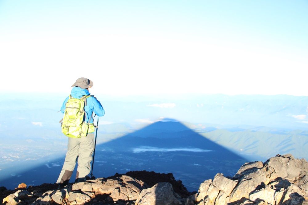
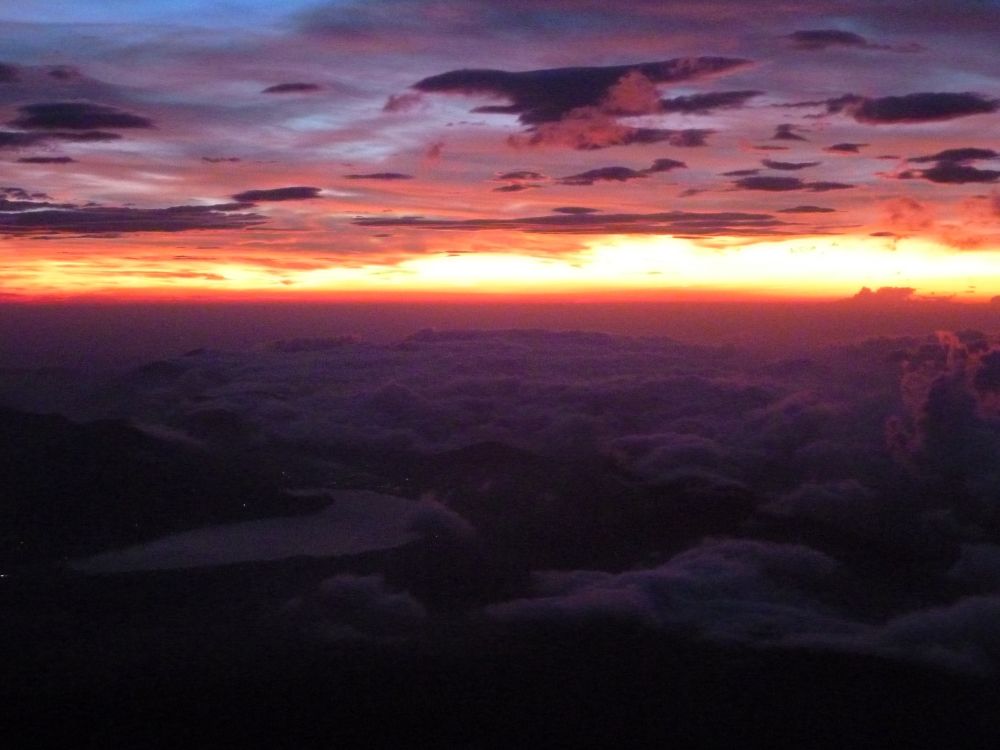
Sunrise: Can be seen from 5th station onward
Mountain Hut: Many on the ascent but none on the descent
Congestion: Crowded (crowded beyond the 8th station, where it joins the Subashiri Trail)
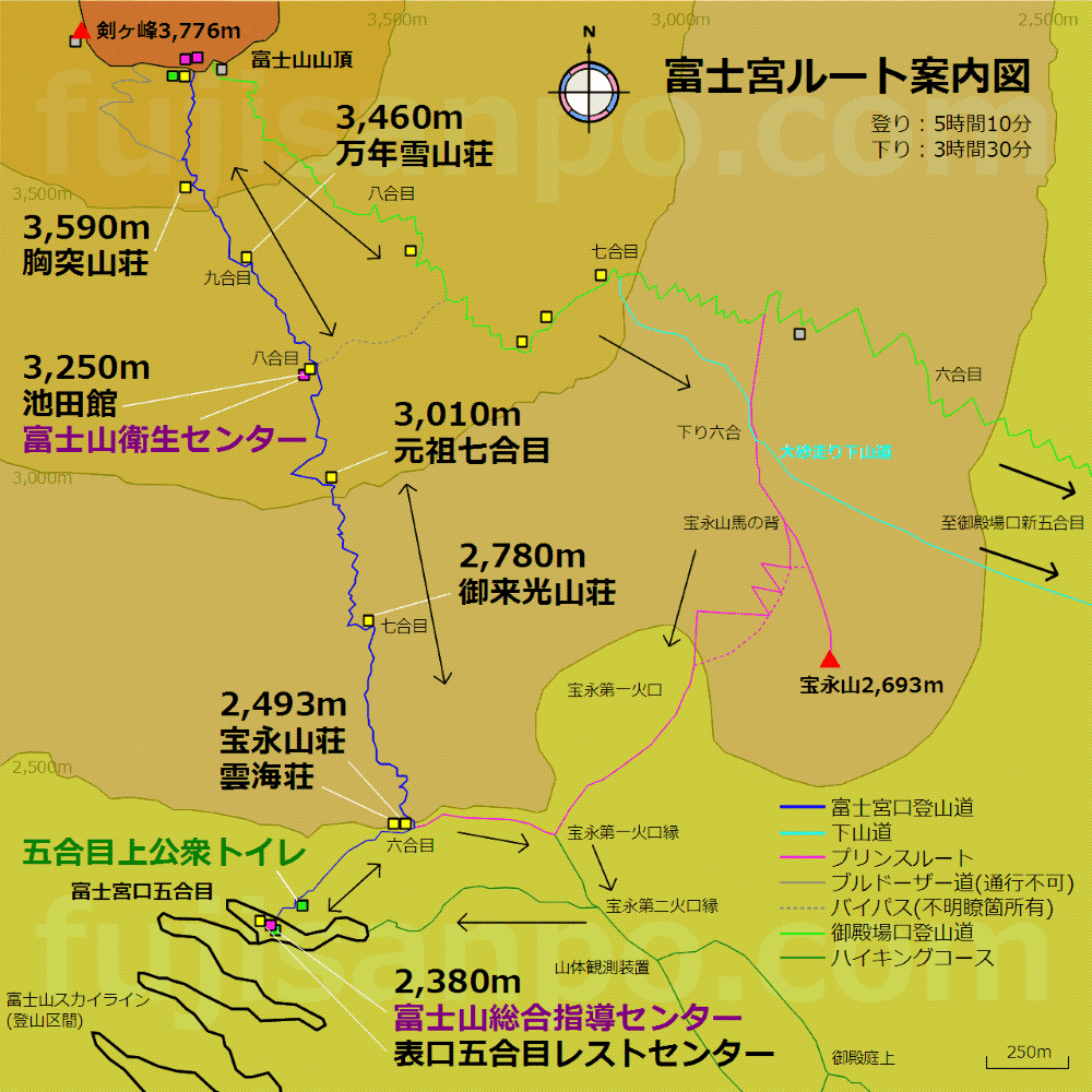
Departure height: 2380 meters
Standard time to ascend and descend: 5 hours / 3 hours
No. of climbers in 2016: ~ 60000
Toilets: 5th station and summit (100 yen)
Aid & rescue system: 8th station
Sunrise: Various on location
Mountain Hut: At each station from 5th to 9.5th
Congestion: Not crowded Features:
The trail for ascent and descent is the same. The climbing route is steep and rocky but since it is short, it quite popular.
Available mountain huts for overnight stay:
6th station: Unkaiso (2,493m)、Houeisansou (2,493m)
7th station (New 7th station): Goraikousansou (2,780m), Ganso 7th stationFujisan Ganso (3,010m)
8th station: Ikedakan (3,250m)
9th station: Mannennyuki Sansou (3,460m), 9.5th station Munatsuki Sansou (3,590m)
Detailed map
Departure height: 1970 m
Standard time to ascend and descend: 6 hours / 3 hours
No. of climbers in 2016: ~ 21000
Toilets: 5th station (200 yen)
Aid & rescue system: None
Sunrise: After the 7th station
Mountain hut: Nine mountain huts on the ascending trail and one on the descending trail below the 7th Station
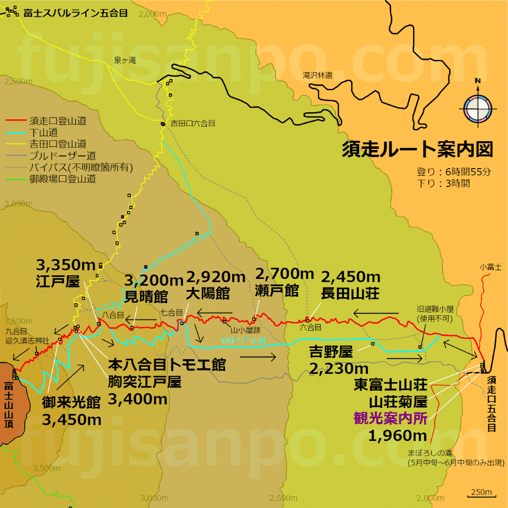
Congestion: Partially crowded (crowded beyond the 8th station, where it joins the Yoshida Trail).Features:
Forest zone up to the 7th station, so make sure to have a torch as you walk through the dark. Once you come out of the forest zone, you can see the sunrise. Trail for ascent and descent is different. The section between the Old 8th Station and the summit is the same as the Yoshida trail. You can run straight down on the volcanic gravel!
Available mountain huts for overnight stay:
6th station: Osada Sanso (2,450m), Original 6th station Seto-kan (2,700m)
7th station: Taiyo-kan (2,920m), Original 7th stationMiharashi-kan (3,200m)
8th station: Edo-ya (Shimo-Edoya, 3,350m), Original 8th station Munatsuki Edoya (Kami-Edoya 3,400m), 8.5th station Goraikou-kan (3,450m)
Summit: Yamaguchi-ya, Tokyo-ya, Ougi-ya
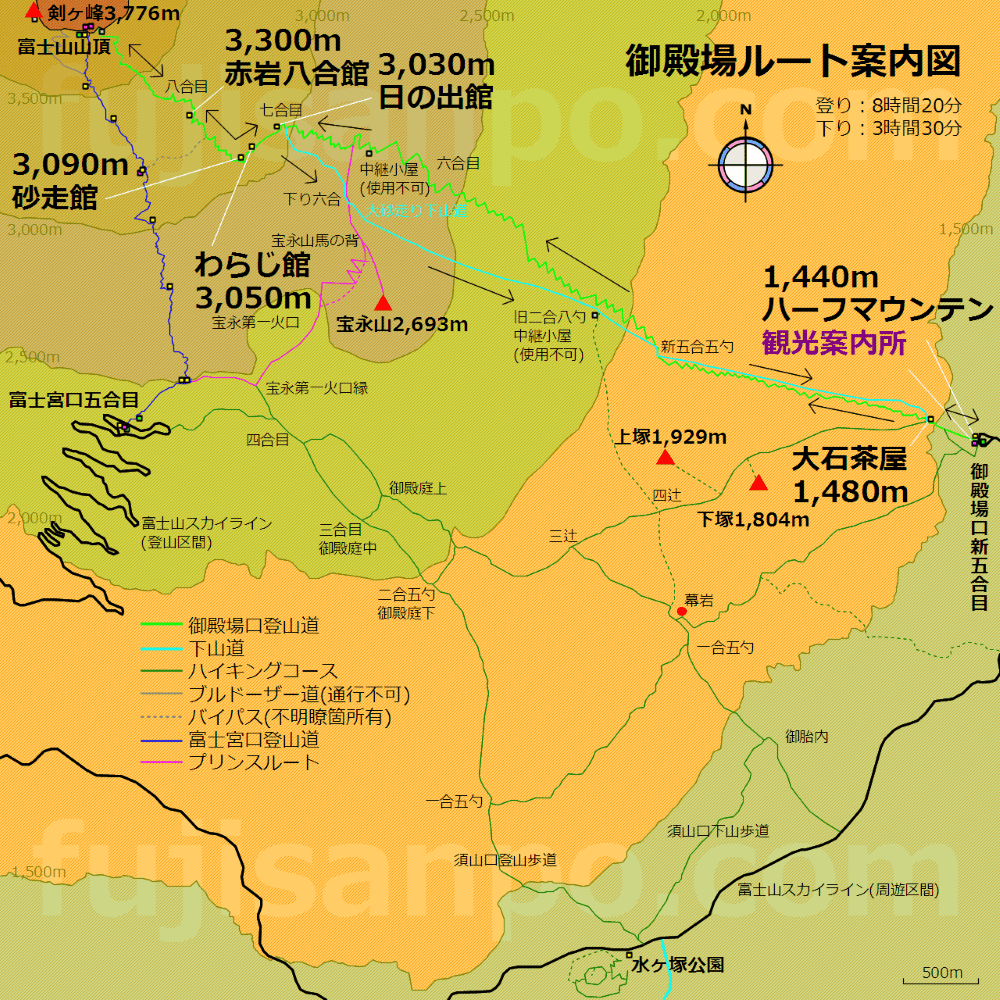
Gotemba Trail: For advanced climbers, not suitable for the elderly
Departure height: 1440 m
Standard time to ascend and descend: 7 hours / 3 hours
No. of climbers in 2016: ~ 16000
Toilets: New 5th station
Aid & rescue system: No first-aid centers
Sunrise: Throughout the trail
Mountain huts: Only a few. None in the section between Oishi-Chaya (near the new 5th station) and the 7th station
Congestion: Not crowdedFeatures:
The longest of all the routes with a gentle slope. It has the least number of climbers and you can see the sunrise and Mt. Fuji from almost anywhere.
Mountain lodges available for accommodation:
7th station: Hinode-kan (Closed in 2017) Waraji-kan (3,050m), 7.5th station Sunabashiri-kan (3,090m)Akaiwa Hachigou-kan (3,300m)
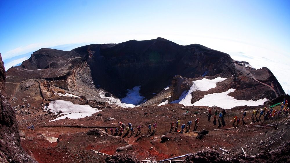
Crater Walk
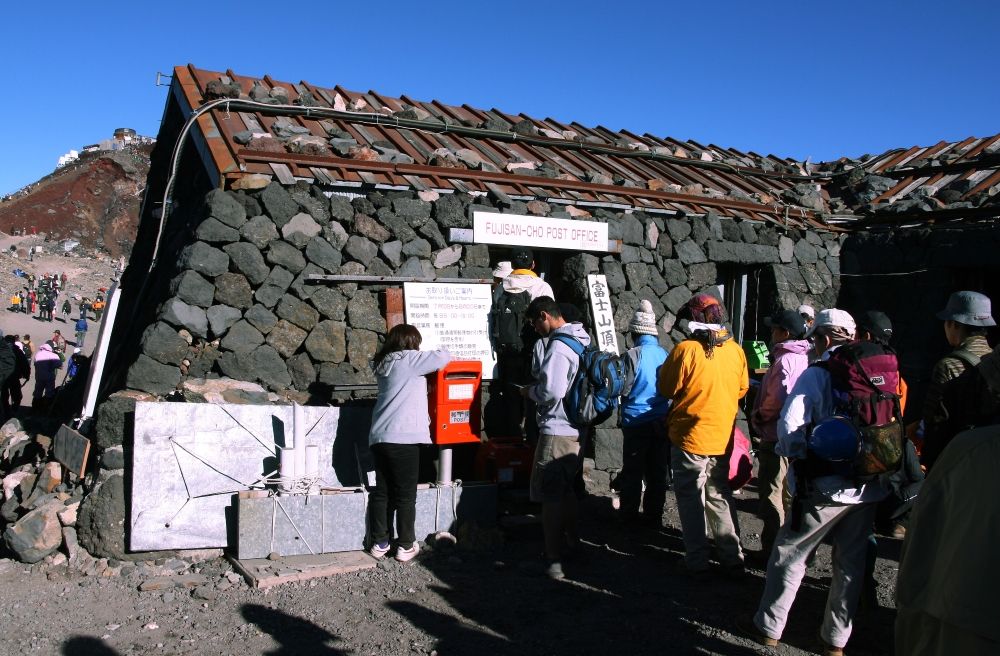
Walk around the 780m-diameter crater of Mt. Fuji, which takes one and a half hours. Visitors can enjoy the beautiful scenery while strolling through the clouds. On the way, you will see the Mt. Fuji Post Office, which is located at the highest point in Japan. You can also acquire a “Certificate for Climbing to the Summit of Mt. Fuji” with your photo.
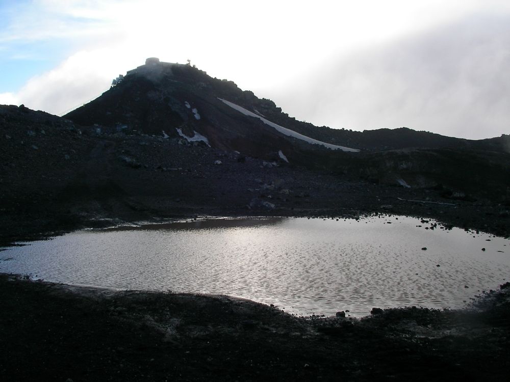
Kengamine and Konoshiro Pond
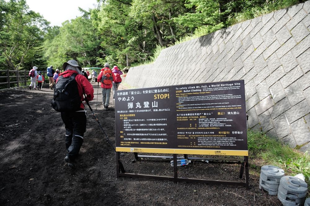
Bullet climbing refers to climbing without resting overnight. Bullet climbers are at 3 times higher risk of injury and illness. You should also remember that people also suffer from altitude sickness on the way down.
Hope this feature has helped you plan a trip to the summit of Mt. Fuji.
Stay safe!